


History in the Redwoods: Hiking Oregon’s Bomb Site Trail
Updated: Sep 1
When most people think of World War II, they picture distant battlefields in Europe or the South Pacific. Few realize that tucked deep inside the old-growth forests of the Rogue River-Siskiyou National Forest near Brookings, Oregon, lies the site of the only wartime aerial bombing on the contiguous United States.
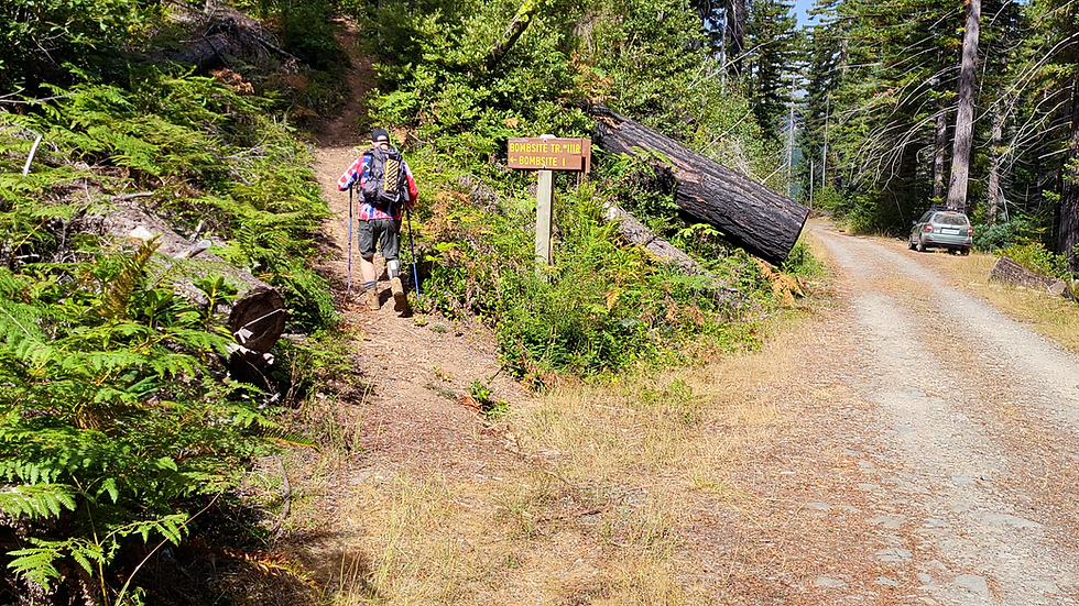
Today, the Bomb Site Trail (#1118) is an easy out-and-back hike beneath a dense canopy of Douglas firs and giant coast redwoods. For hikers and history buffs, it offers a manageable distance with modest elevation gain, coupled with a remarkable story of wartime conflict transformed into a decades-long legacy of peace and reconciliation.
Trail Report
This being an easy hike (though getting to the trailhead is a little sketchy) I'll keep the trail report short and focus on the history behind this trail and the events of September 9th, 1942.
Japanese Bombing Site Trail Specifications
Distance: ~1.6 miles round-trip
Trail Type: Out-and-back singletrack
Elevation Gain: ~100 feet
Difficulty: Easy to Moderate (amputee scale)
Trail Surface: Packed dirt, loose gravel, exposed tree roots, and small rock steps.

The trail starts out amongst new forest growth around the burnt remains of forest fires that occurred naturally and not because of a Japanese bombing. You’ll start out at 1,591 feet above sea level and in about 2/10th of a mile climb up to 1,790 feet. At that point the trail reaches a short plateau before descending to the bombsite at about 1,620 feet.

After the plateau the forest transitions from new growth to a canopy of mature Douglas fir trees with several old growth redwoods mixed in. At about the one-mile point, you’re going to find a bench across from a massive old growth redwood. You may not be tired at this point, but it wouldn’t hurt to take a moment to read the plaque on the bench and give some thought to the folks that went through WWII.


Shortly after the bench, you’ll be hiking up a short incline to the signs that go into the history of the event and a viewing platform from which you look down to the bombsite.

Go back down the trail to the first sign and there you’ll find a short path going down to the actual bombsite. If you’re so inclined, say a short prayer to Nobuo Fujita, a man who was once an enemy and became a friend.

The History: The Bombing of Wheeler Ridge
On September 9, 1942, Japanese Navy pilot Nobuo Fujita catapulted off the surfaced submarine I-25 off the southern Oregon coast in a Yokosuka E14Y "Glen" floatplane. Strapped to his flight seat was his family’s 400-year-old Samurai katana.
Fujita’s mission was unprecedented: drop two 150-pound incendiary thermite bombs over the dense forests of Mount Emily and Wheeler Ridge. The Japanese military calculated that starting massive forest fires along the Pacific Northwest coast would spark widespread panic and force the U.S. to pull military assets away from the Pacific war zone to fight domestic blazes.
Fujita dropped his payload, but the plan stalled due to two factors:
Oregon Weather: Heavy coastal rain the previous evening left the canopy and forest floor thoroughly damp, preventing the incendiary bombs from igniting large fires.
Swift Response: Forest Service fire lookouts on Mount Emily spotted the aircraft and smoke columns, quickly dispatching crews to extinguish the smoldering spot fires before they could spread.
Fujita flew a second nighttime sortie on September 29, but wet conditions again neutralized the bombs.
War Enemy to Ambassador of Peace
The story took an unprecedented turn twenty years later. In 1962, the Brookings Jaycees (Junior Chamber of Commerce) extended a bold invitation: they invited Nobuo Fujita to attend the town’s annual Azalea Festival as an honoured guest.
Apprehensive about how he would be received, Fujita brought his 400-year-old family katana with him, intending to perform ritual suicide (seppuku) if the townspeople responded with hatred or violence.
Instead, the people of Brookings welcomed Fujita and his family with open arms and warm hospitality. Deeply moved, Fujita presented his ancestral samurai sword to the city as a symbol of forgiveness and international peace.

Over the next three decades, Fujita forged a lifelong bond with the city:
The Peace Tree (1992): On the 50th anniversary of the bombing, Fujita returned to Wheeler Ridge and planted a young Coast Redwood seedling at the exact bomb crater as a living monument to peace.
Civic Friendship: He hosted local Brookings high school students in Japan, donated to the Chetco Community Public Library to buy children's books, and was designated an Honorary Citizen of Brookings shortly before joining his ancestors in 1997.
Today, his family samurai sword remains on public display inside the Chetco Community Public Library in Brookings.
Important Logistical Notes:
Road Conditions: Forest Road 1205 is a 15-mile unpaved, single-lane gravel forest road. High-clearance or AWD/4WD vehicles are recommended, especially during wet season months when washouts, deep potholes and mud are common.
Amenities: There are no restrooms or potable water at the trailhead. Plan accordingly. Make sure to pack out all trash.
Cell Coverage: Cell phone service drops off shortly after leaving Highway 101. Download offline maps prior to driving into the forest.
Limited Parking: There’s room for 3-4 cars at the pullout by the trailhead and down the road about 200 feet.
This isn’t an easy trail to get to and it’s not a challenging hike with spectacular views, but if you’re a history buff like me, it’s a must-hike trail.

Comments